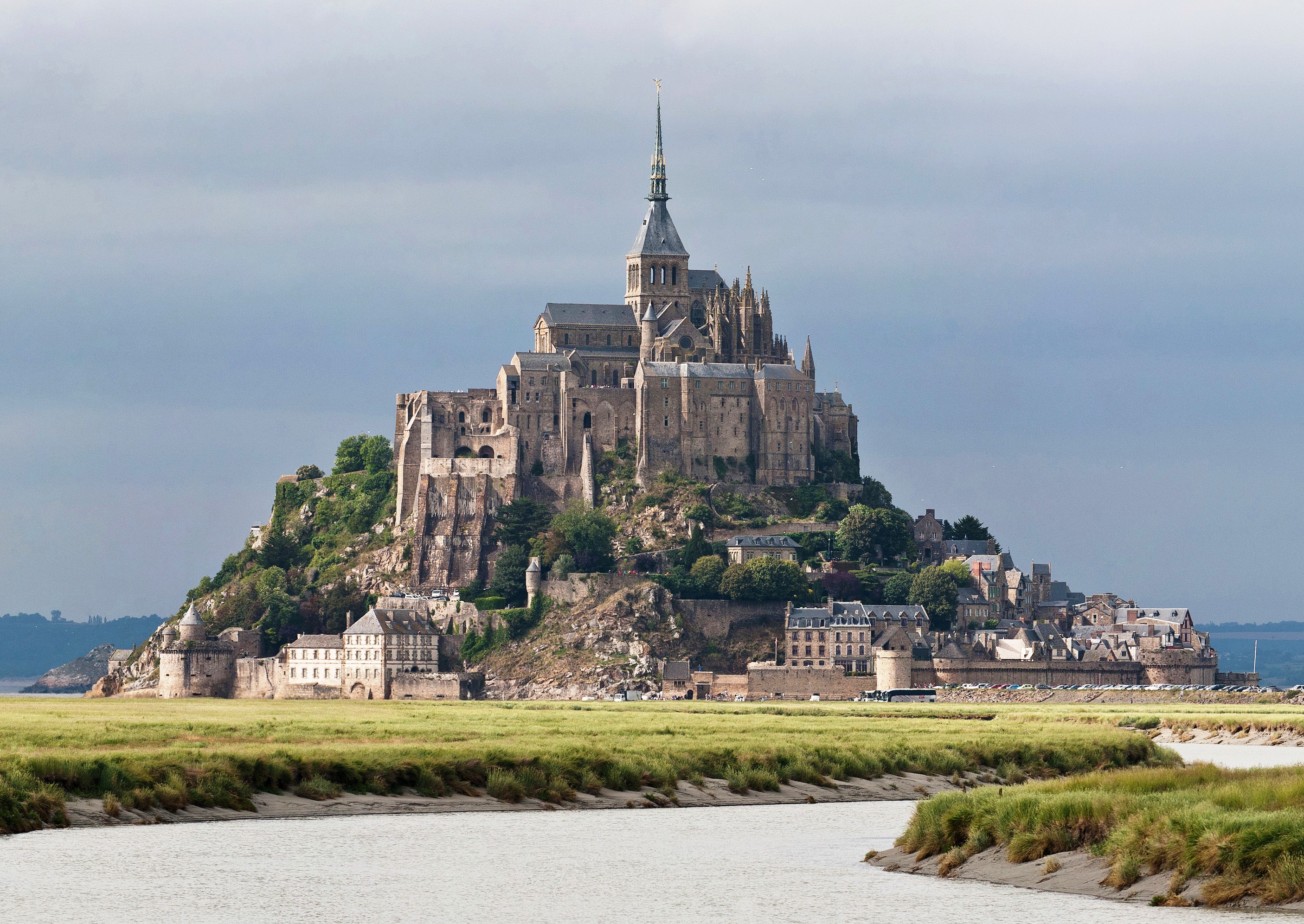
Mont Saint-Michel was previously connected to the mainland via a tidal causeway, i.e., a trackway covered at high tide and revealed at low tide. This connection has been altered over the centuries. The coastal flats have been polderised to create pastureland, thus the distance between the shore and the south coast of Mont Saint-Michel has decreased, and the Couesnon River has been canalised, reducing the dispersion of the flow of water, and thereby encouraging a silting-up of the bay. In 1879, the tidal causeway was converted into a raised or dry causeway. This prevented the tide from scouring the silt around the mount.
On 16 June 2006, the French prime minister and regional authorities announced a €164 million project (Projet Mont-Saint-Michel)[6] to build a hydraulic dam using the waters of the river Couesnon and of tides to help remove the accumulated silt deposited by the rising tides, and to make Mont Saint-Michel an island again. The project's completion is scheduled for 2015.[7]
The construction of the dam began in 2009 and is now complete[when?]. The project also included the removal of the causeway and its visitor car park. The new car park is on the mainland, about two kilometres (1.2 miles) or so from the island. A light bridge that allows the waters to flow freely around the island will improve the efficiency of the now operational dam. Visitors can walk or use small shuttles to cross the causeway; the future bridge too will be open to pedestrians and non-motorised vehicles. (Wikipedia)
my next pilgrimage this coming October, St Michel in France
Linkback: https://tubagbohol.mikeligalig.com/index.php?topic=77835.0

